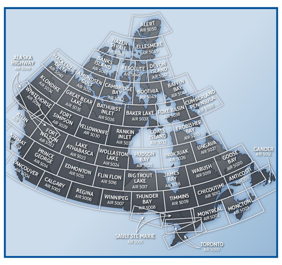


Canadian VNC VFR Navigational Charts 1:500,000 scale.
The VFR Navigation Chart (VNC) is used by VFR pilots on short to extended cross-country flights at low to medium altitudes and at low to medium airspeeds. The chart displays aeronautical information and sufficient topographic detail to facilitate air navigation through the use of a unique colour scheme and layer tinting. There are 52 charts in the series. The scale is 1:500,000.
Please select chart(s) you would like to order and add to cart, then select the next chart(s) and add to cart.